Atlas 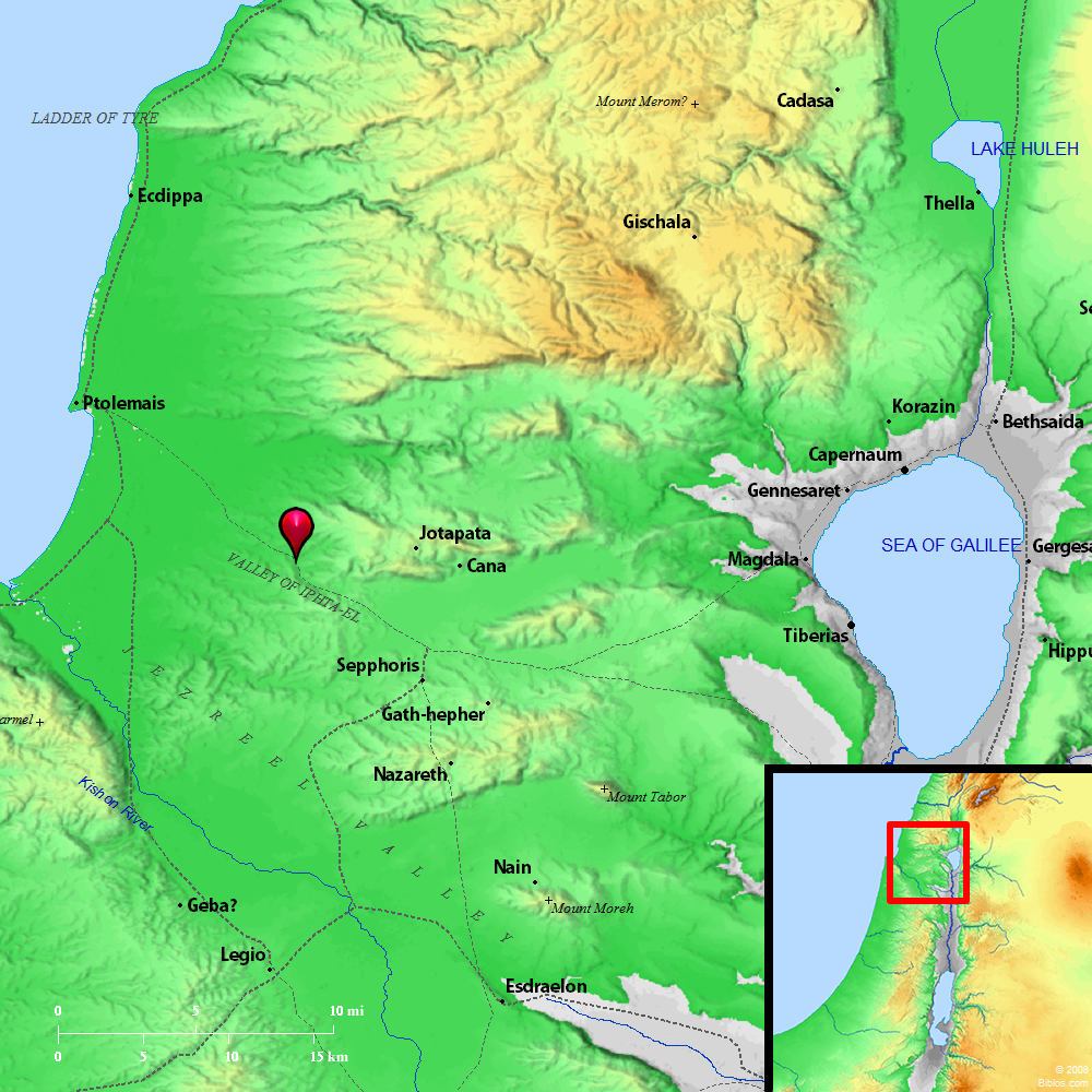 Valley of Iphtahel and surrounding region Maps Created using Biblemapper 3.0 Additional data from OpenBible.info You are free to use up to 50 Biblos coprighted maps (small or large) for your website or presentation. Please credit Biblos.com. Occurrences Joshua 19:14 The border turned around it on the north to Hannathon; and it ended at the valley of Iphtah El;Joshua 19:27 It turned toward the sunrise to Beth Dagon, and reached to Zebulun, and to the valley of Iphtah El northward to Beth Emek and Neiel. It went out to Cabul on the left hand, Encyclopedia IPHTAH-ELif'-ta-el (yiphtach-'el; the King James Version Jiphtah-el): The valley of Iphtah-el lay on the North border of Zebulun (Joshua 19:14, 27). Northwest of the plain of el-Battauf stands a steep hill, connected only by a low saddle with the hills on the North. The name Tell Jefat suggests the Jotapata of Josephus (BJ, III, vi, i; vii, i, etc.), and the place answers well to his description. It probably corresponds to the ancient Iphtah-el. In that case the valley is most probably that which begins at Tell Jefat, passes round the South of Jebel Kaukab, and, as Wady 'Abellin, opens on the plain of Acre. |
    |